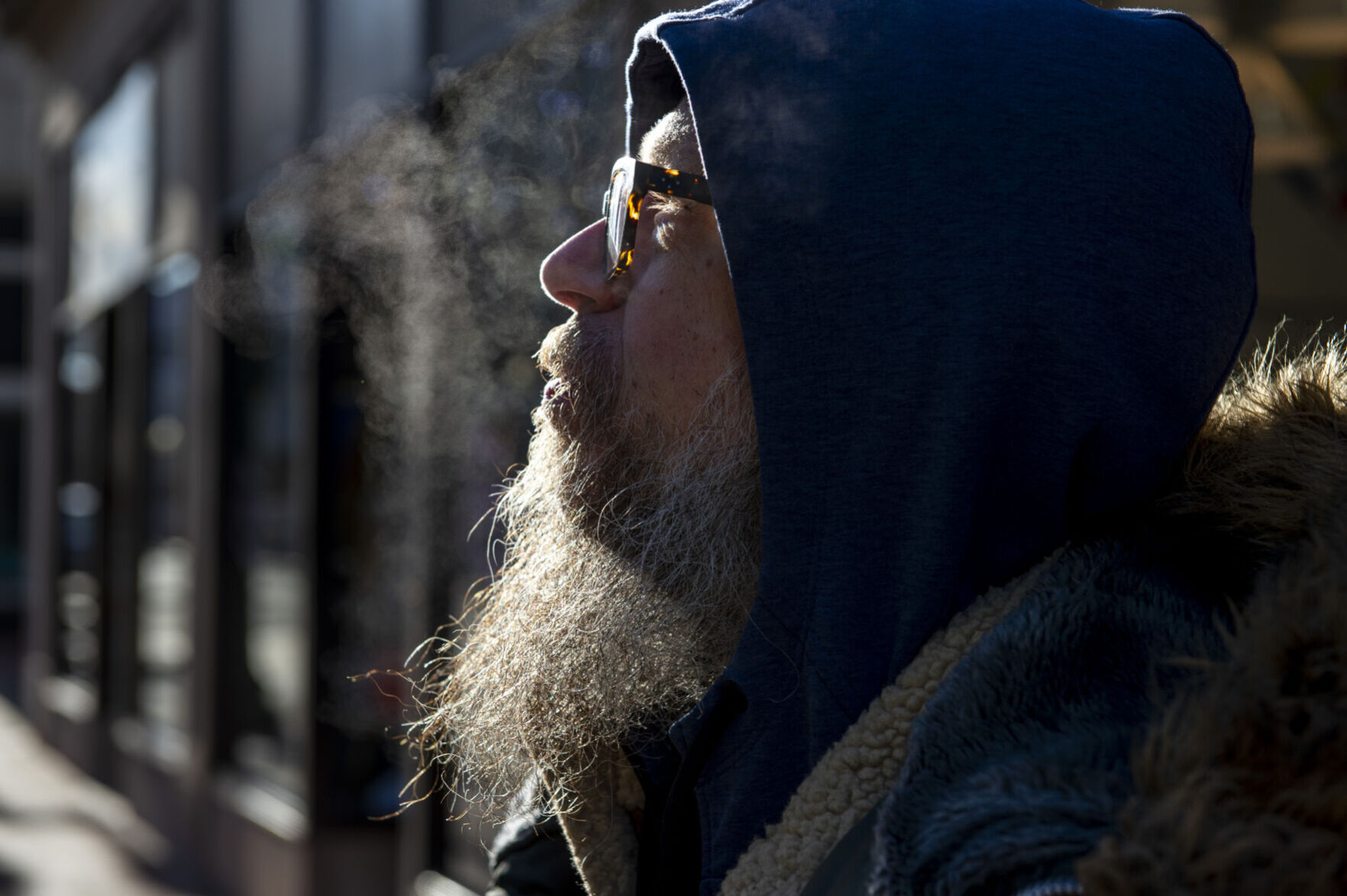
Super Weenie owner Jason Myer walks to his restaurant in downtown Charleston on Tuesday, Jan. 20, 2026. The morning temperatures hovered around 15 degrees, according to the National Weather Service.
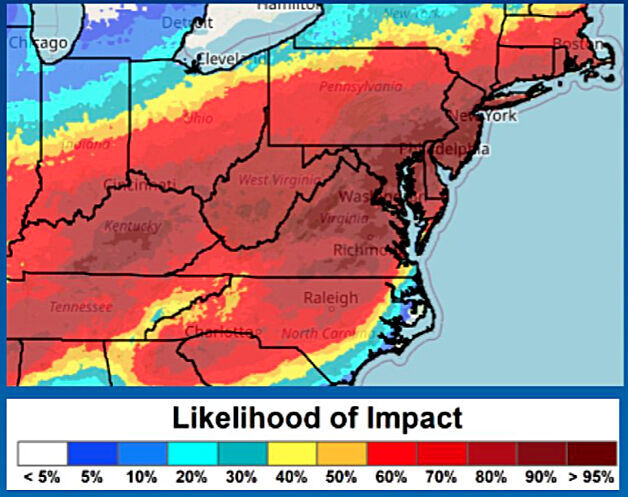
A big winter storm is likely to hit West Virginia on the weekend of Jan. 24-25, 2026, according to the National Weather Service in Charleston, with a chance for 6 inches or more of snow. This map shows the likelihood of a storm, as of 4:40 a.m. Wednesday.
A big winter storm is likely to hit West Virginia on the weekend of Jan. 24-25, 2026, according to the National Weather Service in Charleston, with a chance for 6 inches or more of snow. This map shows the likelihood of a storm, as of 4:40 a.m. Wednesday.
NATIONAL WEATHER SERVICE | Courtesy photo
Forecasters still don't know how much snow we'll get, but there is a high confidence — about a 50% chance — in a major, high-impact winter storm bringing significant snowfall area-wide this weekend. There is also a chance for freezing rain and sleet in and just west of the eastern highlands.
However, forecasters still don't know yet how far north and west the snow mixes with sleet and freezing rain to produce ice conditions.
The NWS has posted a winter storm watch for all of West Virginia from 7 a.m. Saturday through 7 a.m. Monday.
Forecasters predict 6-12 inches of snow for parts of the state.
“There is growing confidence” for at least 6 inches of snow across West Virginia, said Joe Curtis, meteorologist for the National Weather Service in Charleston. “We’re not sure if it’s going to be a mix of ice and snow.”
It all depends on where this low-pressure system tracks. If it moves one way, we could see more snow. If it moves another way, we could see more ice.
“Either way,” Curtis said, “this will be an impactful winter storm."
A Winter Storm Watch is in effect for a major winter storm with significant snow this weekend. There is still some uncertainty as to how far north and west sleet and freezing rain mixes in Saturday night and Sunday.#WVwx#OHwx#KYwx#VAwxpic.twitter.com/EoQOGk3pZl
All of this begins in the Charleston area with dropping temperatures drop into the lower 20s late Thursday night into Friday when we’ll only see a high around freezing and a low around 10.
Snow is likely Saturday after 1 p.m. with a high in the low 20s. There is a 100% chance for snow Saturday night.
There’s a 90% chance for more snow on Sunday, with a high around freezing.
Temperatures drop Sunday night, and below-freezing temperatures continue early next week, according to the NWS.
We could see a low in the single digits Monday night.
Super Weenie owner Jason Myer walks to his restaurant in downtown Charleston on Tuesday, Jan. 20, 2026. The morning temperatures hovered around 15 degrees, according to the National Weather Service.
LAURA BILSON | Gazette-Mail
In your home or business, protect pipes from freezing and know where your water shut-off valves are located
Wear warm, loose-fitting clothes in layers
Check to make sure your family and friends are OK
Bring in pets
Use off-street parking and/or garages to allow salt trucks and plows clear passage to maintain streets and roads
A warming shelter may be open in Charleston from 7 p.m.-7 a.m. Friday night at the Bream SHOP, 319 Washington St. W. on Charleston’s West Side. Additional days may be added, depending on overnight lows.
Local emergency managers and community groups are working to report open shelters to West Virginia 211. Those in need of assistance should visit wv211.org or call 211 for information on nearby shelters and resources.
Residents without adequate heating sources should contact their local emergency manager or health department for information on the nearest shelter or warming station.
State, local government agencies are ready
On Wednesday evening, Gov. Patrick Morrisey declared a State of Preparedness for all 55 counties as a winter storm is expected to impact the state throughout the upcoming weekend.
The State of Preparedness allows the West Virginia Emergency Management Division to prepare staff and resources to respond in the event of an emergency. As a result of Wednesday’s proclamation, agencies have been placed on standby and are prepared to report to the State Emergency Operations Center if needed.
The Kanawha County Commission on Wednesday issued a State of Preparedness for the approaching storm that extends from Saturday through Monday, urging county residents to limit travel, when possible, keep emergency supply kits in homes and bring pets indoors.
The county commission also urged residents to check on elderly neighbors and monitor local news and follow Kanawha County on social media for storm updates.
CLICK HERE to follow the Charleston Gazette-Mail and receive


